PSA6Plaenterwald


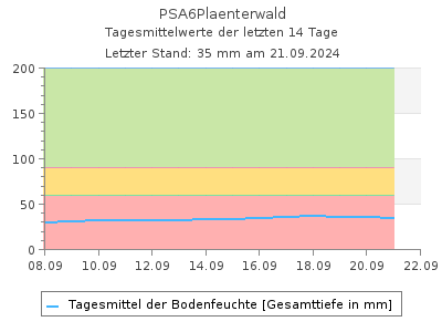
Aktuelle Bodenfeuchte-Werte als Tabelle
Letzter Tagesmittelwert (26.02.2026):
23,1 mm in 15 cm Bodentiefe
Werte Bodenfeuchte in 15 cm Bodentiefe in mm im Intervall von 2 Stunden (in MEZ), Quelle: Land Berlin
|
00:00 |
02:00 |
04:00 |
06:00 |
08:00 |
10:00 |
12:00 |
14:00 |
16:00 |
18:00 |
20:00 |
22:00 |
| 25.02.2026 | 24,2 |
24,1 |
24,0 |
23,9 |
23,8 |
23,8 |
23,7 |
23,6 |
23,5 |
23,3 |
23,2 |
23,1 |
| 24.02.2026 | 27,3 |
26,8 |
26,4 |
26,1 |
25,8 |
25,5 |
25,3 |
25,1 |
24,9 |
24,6 |
24,5 |
24,3 |
| 23.02.2026 | 28,0 |
27,3 |
26,8 |
26,4 |
26,1 |
25,8 |
25,6 |
25,4 |
25,2 |
25,9 |
27,1 |
27,9 |
| 22.02.2026 | 22,6 |
22,6 |
22,7 |
22,7 |
22,8 |
22,9 |
23,3 |
24,6 |
25,8 |
27,2 |
28,3 |
27,8 |
| 21.02.2026 | 20,0 |
20,0 |
20,0 |
19,9 |
19,9 |
19,9 |
19,9 |
20,2 |
21,0 |
21,7 |
22,3 |
22,5 |
| 20.02.2026 | 20,7 |
20,7 |
20,6 |
20,5 |
20,4 |
20,4 |
20,3 |
20,2 |
20,1 |
20,1 |
20,1 |
20,0 |
| 19.02.2026 | 21,3 |
21,2 |
21,2 |
21,2 |
21,1 |
21,0 |
20,9 |
20,9 |
20,8 |
20,8 |
20,8 |
20,7 |
| 18.02.2026 | 21,4 |
21,4 |
21,4 |
21,4 |
21,3 |
21,3 |
21,3 |
21,3 |
21,3 |
21,3 |
21,3 |
21,3 |

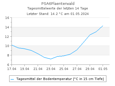
Aktuelle Bodentemperatur-Werte als Tabelle
Letzter Tagesmittelwert (26.02.2026):
4,61 ░C in 15 cm Bodentiefe
Werte Bodentemperatur in 15 cm Bodentiefe in ░C im Intervall von 2 Stunden (in MEZ), Quelle: Land Berlin
|
00:00 |
02:00 |
04:00 |
06:00 |
08:00 |
10:00 |
12:00 |
14:00 |
16:00 |
18:00 |
20:00 |
22:00 |
| 25.02.2026 | 4,53 |
4,48 |
4,30 |
4,04 |
3,81 |
3,70 |
3,47 |
3,60 |
3,99 |
4,61 |
4,90 |
4,82 |
| 24.02.2026 | 3,96 |
3,99 |
3,91 |
3,96 |
3,96 |
3,96 |
3,99 |
4,01 |
4,20 |
4,51 |
4,59 |
4,59 |
| 23.02.2026 | 1,70 |
2,12 |
2,30 |
2,40 |
2,53 |
2,53 |
2,64 |
2,95 |
3,23 |
3,75 |
3,91 |
3,99 |
| 22.02.2026 | 0,450 |
0,450 |
0,480 |
0,450 |
0,450 |
0,450 |
0,450 |
0,450 |
0,480 |
0,690 |
1,08 |
1,28 |
| 21.02.2026 | 0,450 |
0,530 |
0,450 |
0,480 |
0,450 |
0,450 |
0,450 |
0,500 |
0,480 |
0,450 |
0,450 |
0,450 |
| 20.02.2026 | 0,530 |
0,580 |
0,560 |
0,500 |
0,530 |
0,480 |
0,450 |
0,450 |
0,450 |
0,480 |
0,500 |
0,560 |
| 19.02.2026 | 0,630 |
0,580 |
0,630 |
0,580 |
0,610 |
0,580 |
0,580 |
0,660 |
0,580 |
0,530 |
0,580 |
0,530 |
| 18.02.2026 | 0,580 |
0,560 |
0,530 |
0,500 |
0,560 |
0,560 |
0,560 |
0,560 |
0,500 |
0,500 |
0,560 |
0,580 |
Pegel Berlin
| Name | PSA6Plaenterwald |
|---|
| Stra▀e | Plõnterwald |
|---|
| Bezirk | Treptow-K÷penick |
|---|
| Betreiber | Pflanzenschutzamt |
|---|
| Messtiefe | bis 85 cm |
|---|
| Standort Charakteristik | Wald |
|---|
| Vegetation/Baumart | Flatterulme (Ulmus laevis), Altbaum |
|---|
| Pflanzjahr | |
|---|
| Bodenart | ms (Mittelsande), fS (Feinsande), Sl 3 (mittellehmiger Sand) |
|---|
| Rechtswert (UTM 33 N) | 397250.22 |
|---|
| Hochwert (UTM 33 N) | 5815090.88 |
|---|
Als Favorit speichern
Als Favorit entfernen
Durch die Liste der Bodenwasser-Messstellen blõttern: